Our 10-day road trip through the Dolomites turned out to be a spontaneous adventure, without planning too much ahead. Choosing a carefree approach without reservations or fixed itineraries, we decided to stay at campings sleeping in a cozy car-bed in the rear. Amazingly, this spontaneous escape turned out to be the best vacation I’ve had in years, with new experiences and adventures all along the way. Even on our first evening, we arrived late and missed the reception of the camping we intended to stay, so we ended up sleeping in a parking lot next to the little town of Toblach.
We had a lot of fun exploring the Dolomites during our road trip. The weather was perfect in early September, with sunny days and no rain, making it great for exploring the beautiful outdoors. The landscapes were amazing, and we enjoyed every moment of our journey.
We discovered extraordinary places every day, each showing a different part of the Dolomite wonders. From the big mountains to quiet spots, our journey felt like an exciting story. Without a doubt, we feel a strong desire to go back, experience the spontaneity again, and start another adventure there.


Now, let’s dive into the adventure and explore the 10 must see places if you’re planning your first trip to the Dolomites.
1. Lago di Braies (Pragser Wildsee)
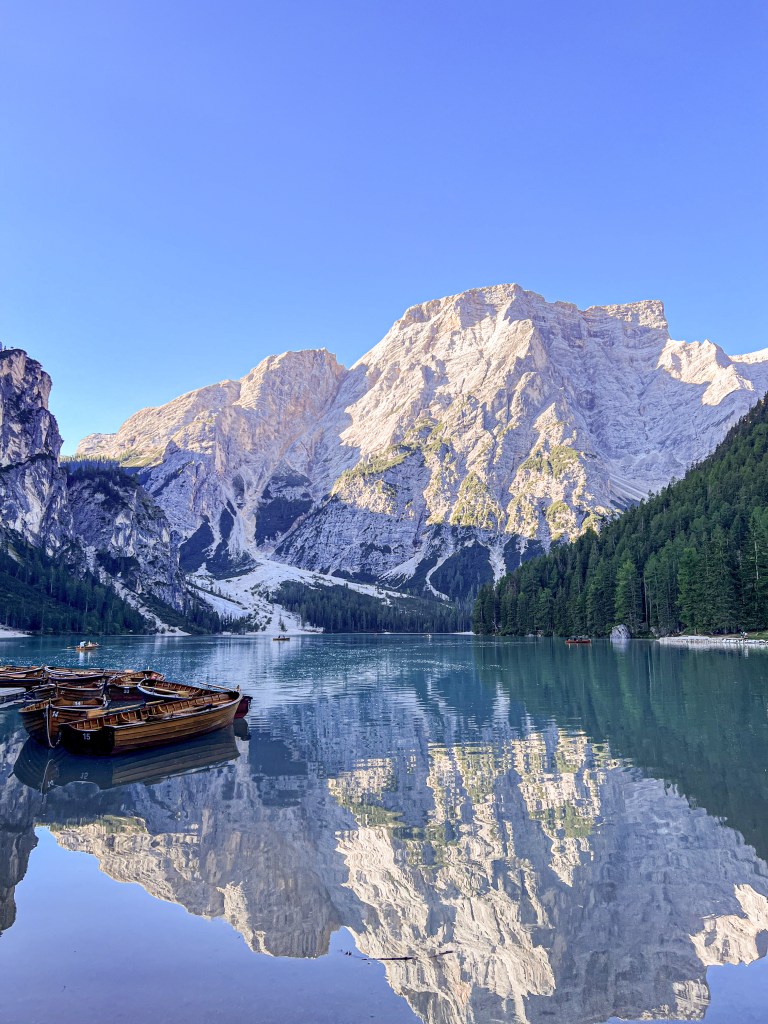
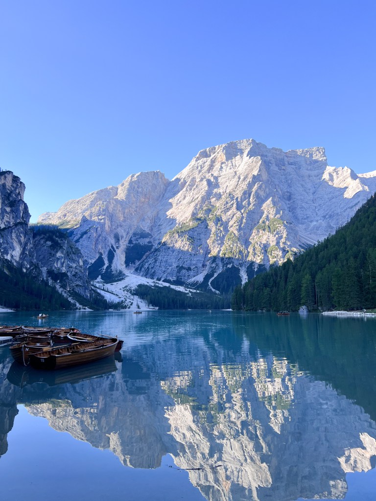
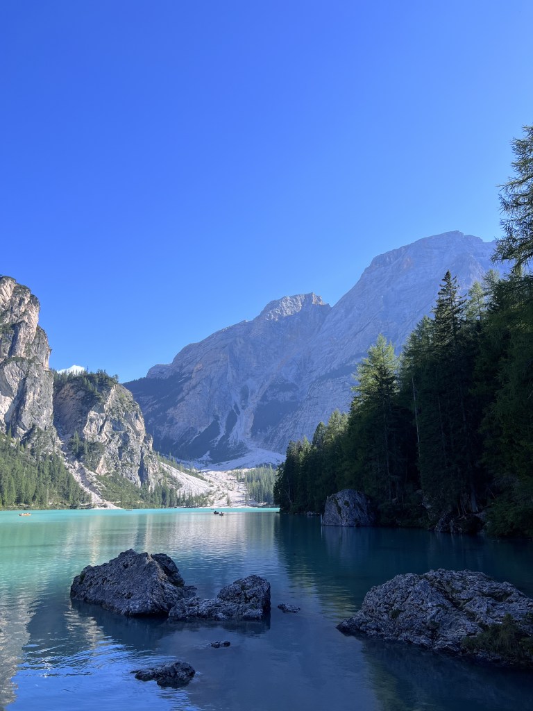
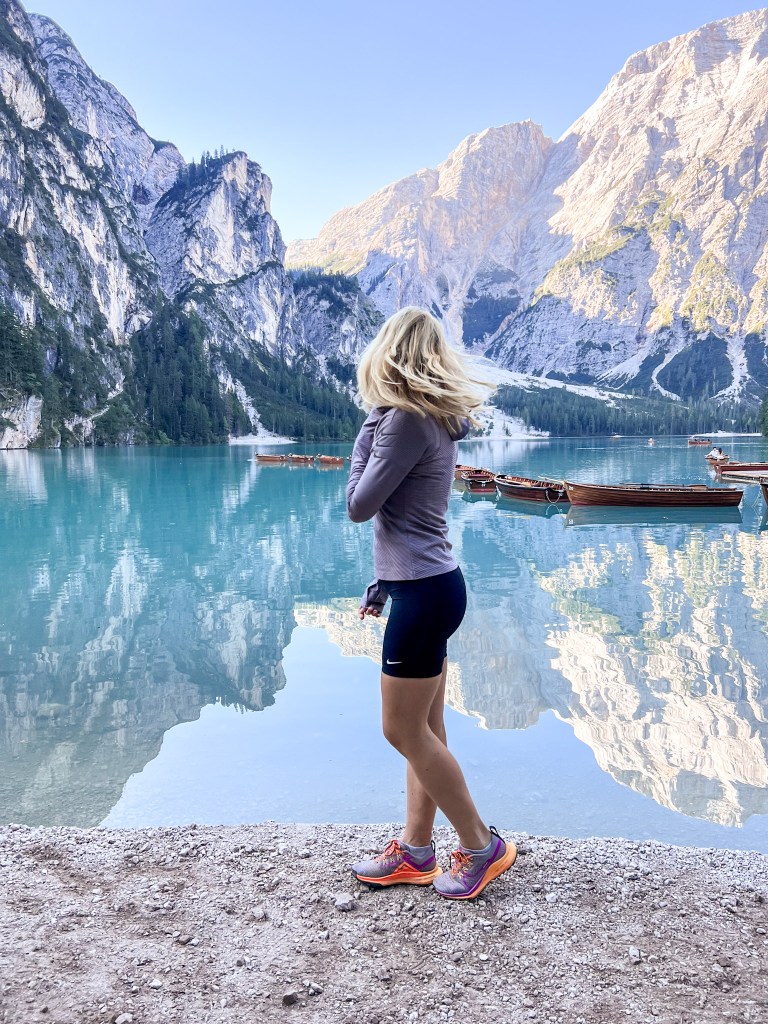
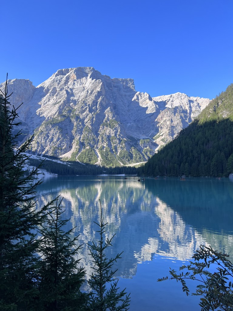
On our first day we visited Lago di Braies, also known as Pragser Wildsee, a mesmerizing alpine lake nested in the heart of the Dolomites in northern Italy. This place was on my must-see destinations list with it’s crystal-clear, emerald-green waters that reflect the towering peaks of the surrounding mountains, creating a picture-perfect setting. Everything looked like a fairytale to me.
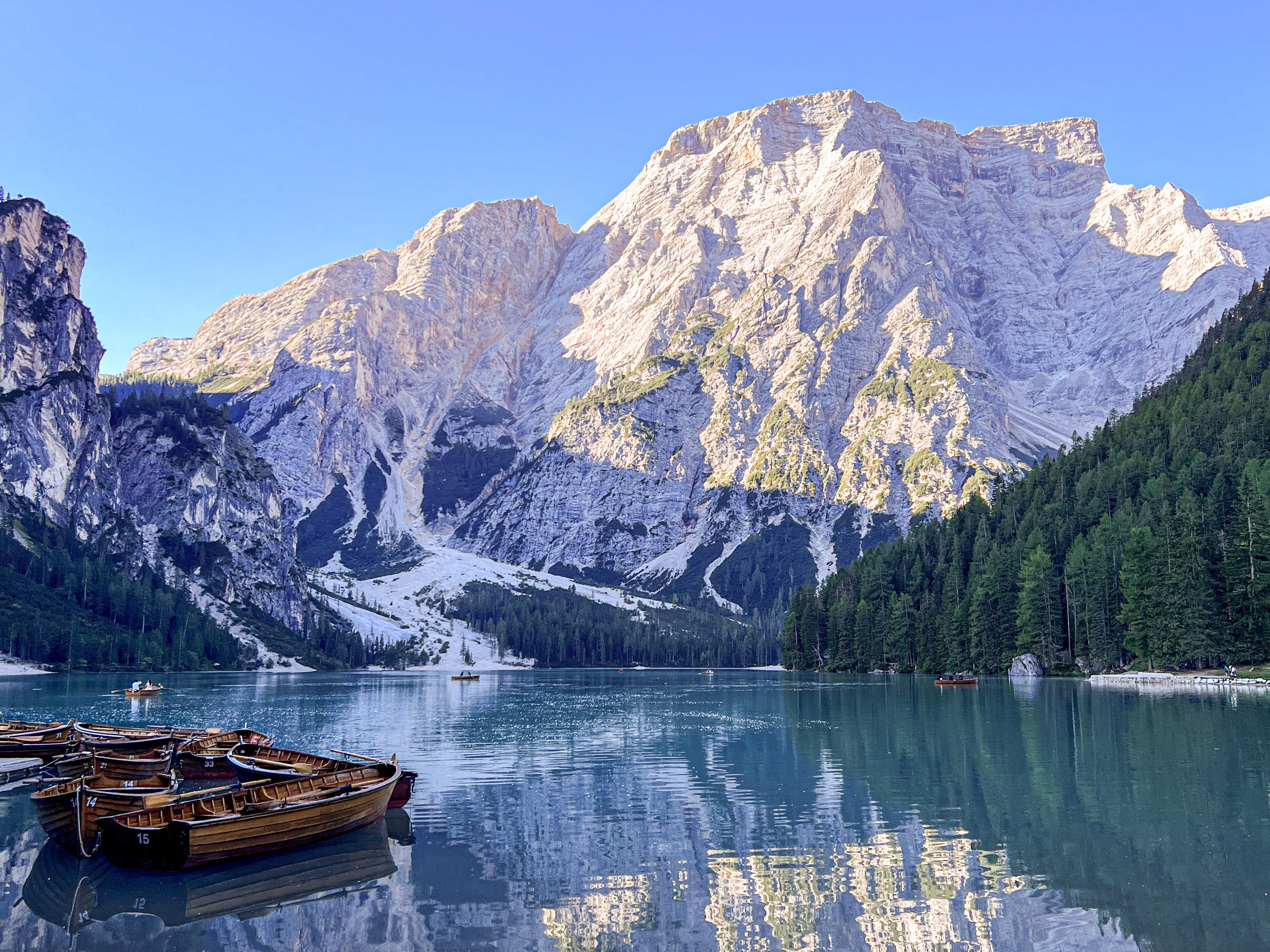
This destination is easily accessible by car or bus. There are four parking lots, we payed 6€ for the whole day. From there the lake is only a few minutes away. Due to the ease of access, it can get really crowded, and you can easily find yourself surrounded by “fancy-dressed influencers”. Most visitors only go to the boat rental, just 100 meters from the car park, but if you want to escape the crowds, there are some great hiking options.
We tried to get there early, before 8 am, to escape the crowds and visit the lake, then we went to an incredible hike, following trail number 1, up to Croda del Becco (Seekofel), the top of the rock above the lake. The hike was quite challenging, but the summit rewarded with an amazing view of the Dolomites, we even got the see Tre Cime.
Hikes around the lake:
1. Lago di Braies circuit: a relatively easy path that encircles the lake, offering stunning views
- Distance: 3.7 km
- Difficulty: easy
- Elevation: 137m
2. Croda del Becco (Seekofel): a more challenging trail that takes you to higher elevations, offering panoramic views of the Dolomites
- Distance: 18 km
- Difficulty: challenging
- Elevation: 1.529m
- Trail number: 1
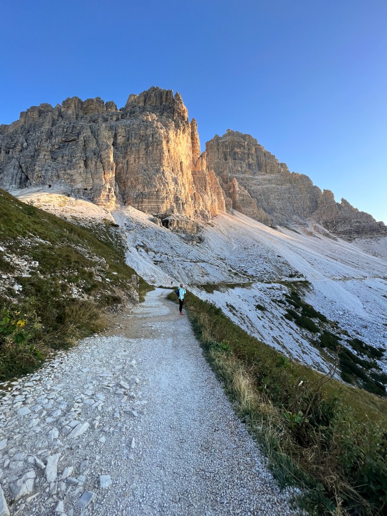
2. Tre Cime De Lavaredo
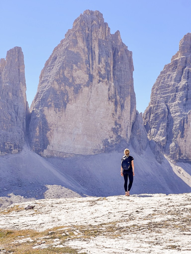
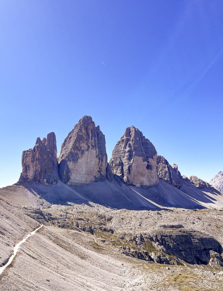
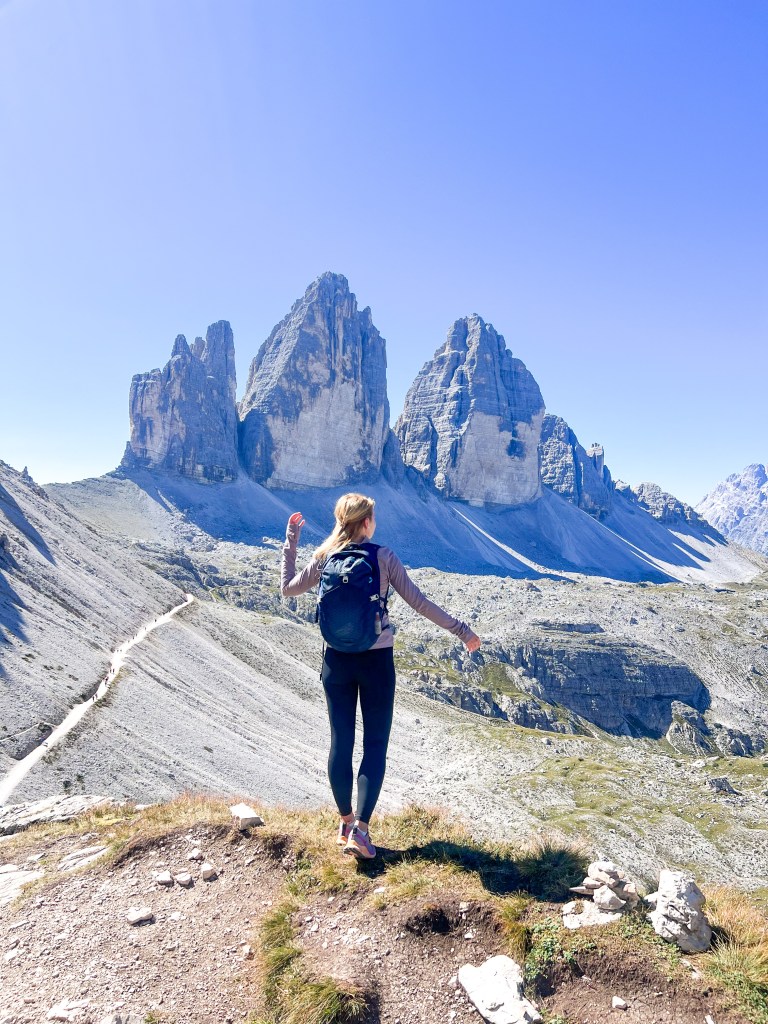
The second day, we headed to Tre Cime De Lavaredo (also known as Drei Zinnen), one of the most popular and iconic mountain formations in the Dolomites. Tre Cime di Lavaredo is one of the most visited destinations for outdoor enthusiasts. A well-maintained trail, “Circuito delle Tre Cime” (“Drei Zinnen Rundweg”) encircles the base of the peaks, offering stunning panoramic views of the three peaks and the surrounding landscapes.
You can either take one of the buses to reach the starting point of the trails (next to Refugio Auronzo), or take the car. To access the parking area there’s a toll where you have to pay 30 €/car, or 10€/person. Since the spots are limited the parking can get full early in the morning and they won’t let any other car in until one of the spots get free.
With this on our minds, we started our hike at 7 am. Undeniably, the colors were amazing, like an early golden hour. The circuit trail around the Tre Cime is around 9 kilometers, but we did a little extension (trail number 104) to Rifugio Zsigmondy-Comici. This route offered a less crowded hiking experience, with amazing landscapes. From there we circled back to the circuit trail and stopped for a well-deserved lunch at Dreizinnenhütte. Seated on the terrace, we ate our Apfelstrudel, accompanied by a cup of coffee, and wondered how insanely unique these peaks are.
Circuito delle Tre Cime: an easy to moderate hike that encircles the three peaks
- Trail number: 101
- Distance: 9.5 km
- Difficulty: easy/moderate
- Elevation: ~400m
- Starting point: Rifugio Auronzo
3. Cadini Di Misurina Viewpoint
The trail to the Misurina viewpoint also starts from Refugio Auronzo (although an alternative route begins at Misurina Lake). We opted for this quick hike on the same day, being only a round trip of less than 4km. Reaching the viewpoint in the late afternoon, the changing lights heightened the beauty of the surrounding mountains. Accessible via a narrow path, the viewpoint offers an spectacular panorama of the nearby peaks, so it’s absolutely worth the hype.
Misurina Viewpoint:
- Distance: 4 km
- Difficulty: easy
- Elevation: 155
- Starting point: Rifugio Auronzo
- Trail number: 117
I highly recommend a visit to Misurina Lake, just a few kilometers from the Tre Cime di Lavaredo National Park. Take a leisurely stroll along the lake, where a short trail offers a picturesque circuit. Personally, I enjoyed a nice morning run around the lake, experiencing a sense of peacefulness.

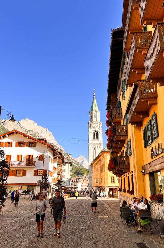
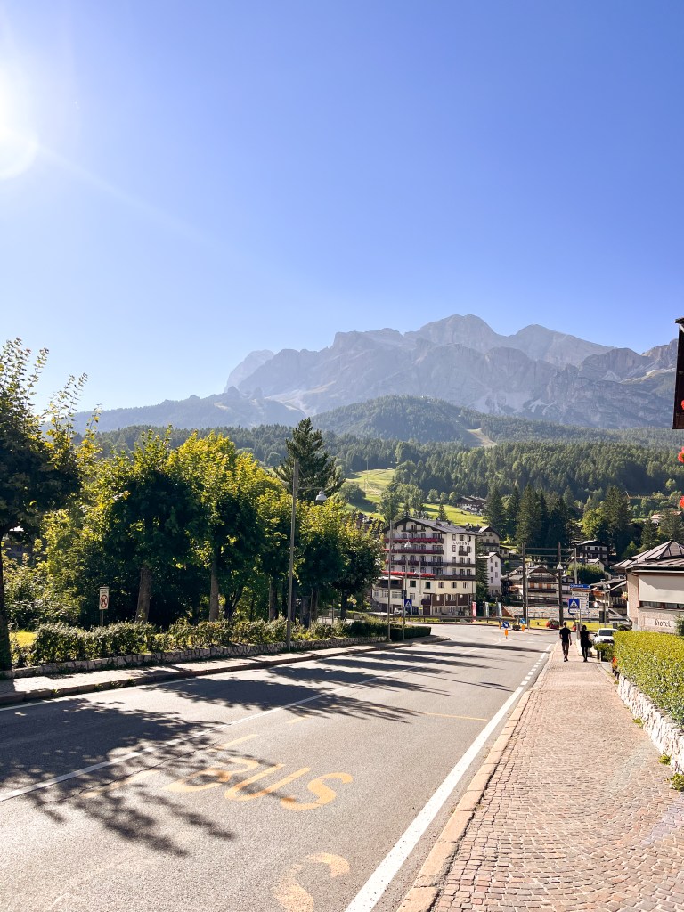
4. Cortina d’Ampezzo
Cortina d’Ampezzo, the ultimate hub for all mountain enthusiasts – whether it’s skiing, trail running, or hiking. Nestled in the heart of the Dolomites, Cortina d’Ampezzo is a gem of northern Italy. Following two days of challenging hikes, we dedicated our third day to exploring Cortina’s charming center. Wandering around, we soaked in the lively atmosphere while sipping on Aperol or beer (maybe more than one or two). For the best pizza in town, head to Pizzeria al Taglio, a tiny little spot where pizza is served by slices. Don’t miss out on the delightful arancini – they’re a true delight. Our appreciation for this cozy spot led us back there after our hike to Lake Sorapis.
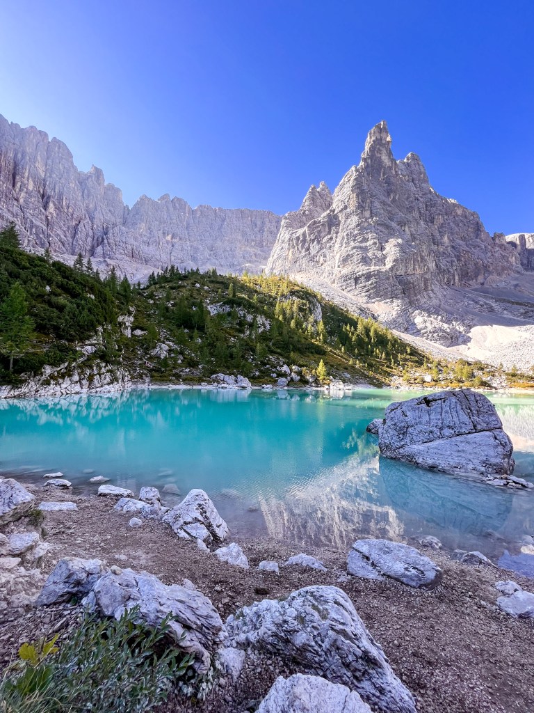
5. Lago di Sorapis
On yet another day filled with adventure, we set out on a hike to Lago di Sorapis, located near Cortina d’Ampezzo. Lago di Sorapis is famous for its turquoise water, which mirrors the beauty of the nearby mountains. The lake’s bright turquoise color makes the stunning scenery even more surreal, the reason why it attracts many visitors during the hiking seasons.
The trailhead is easily accessible by car or public transportation, starting from Passo Tre Croci. To begin the journey, parking is available along the SR48 road, and the good news is that it’s free. Given the limited number of parking spots, I suggest arriving early to secure your space and potentially avoid the crowds, having a better experience.
The trail to the lake took us less then 2 hours, having all the way panoramic views. Once we got to the lake the hike got even better – Mount Sorapis towered above the vibrant, turquoise water and sun was just peeking out from behind the rock. We spent about half an hour relaxing by the lakeside, being amazed by everything around us.
On our return journey, we opted for a more challenging yet exceptionally scenic trail (trail number 216). Along the way, we stumbled upon a perfect spot to pause for lunch, offering a panoramic view of Tre Cime de Lavaredo and lake Misurina.
Lago di Sorapis trail:
- Distance: 13.5 km
- Difficulty: moderate
- Elevation: ~850m
- Starting point: Passo Tre Croci
- Trail number: 215, 216,213
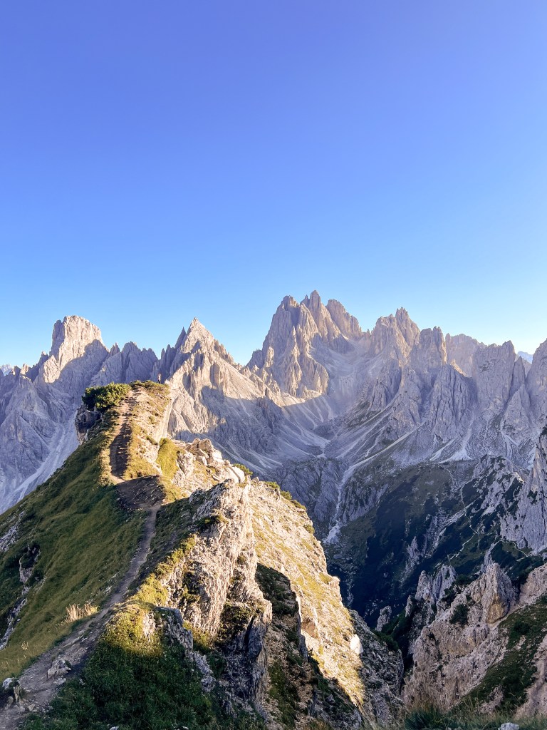
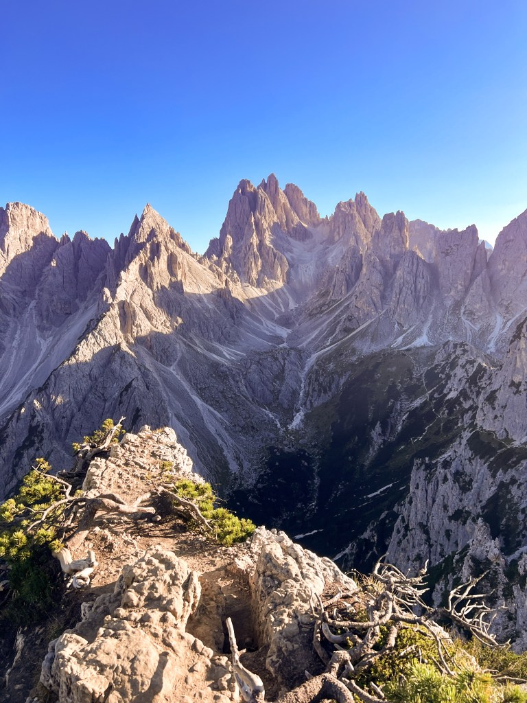
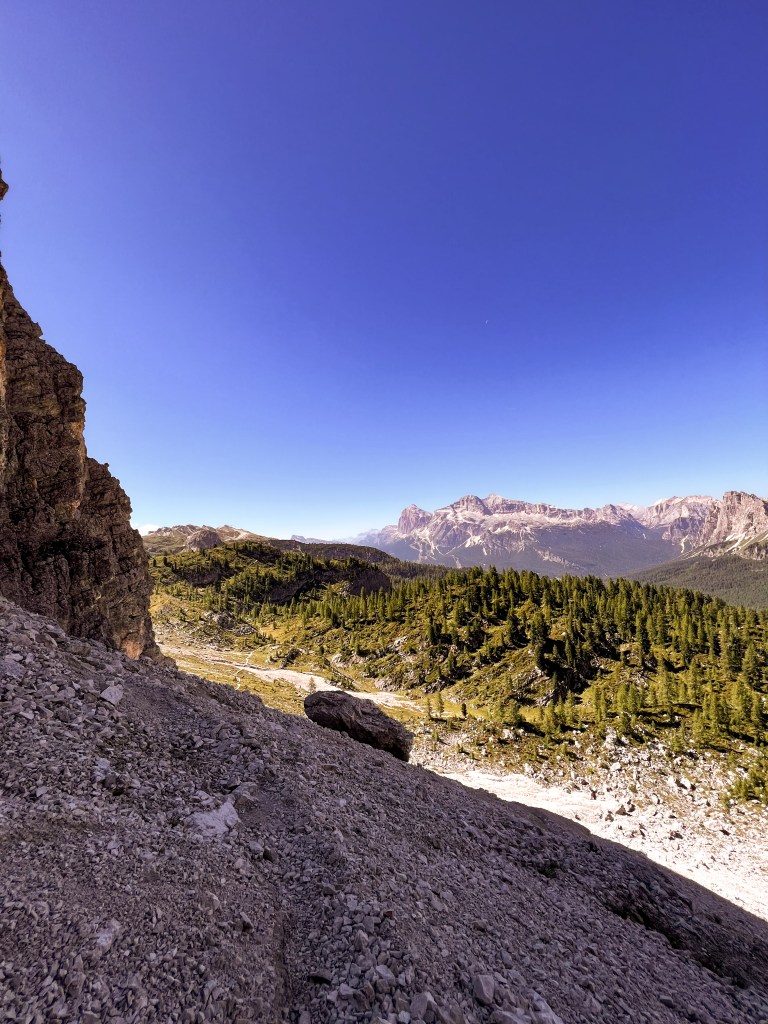
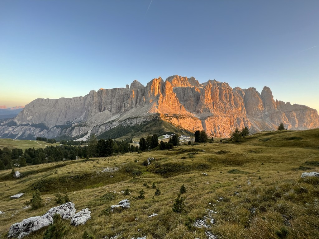
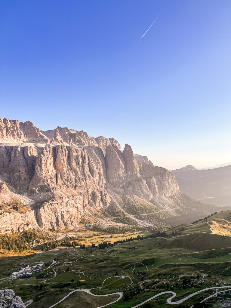
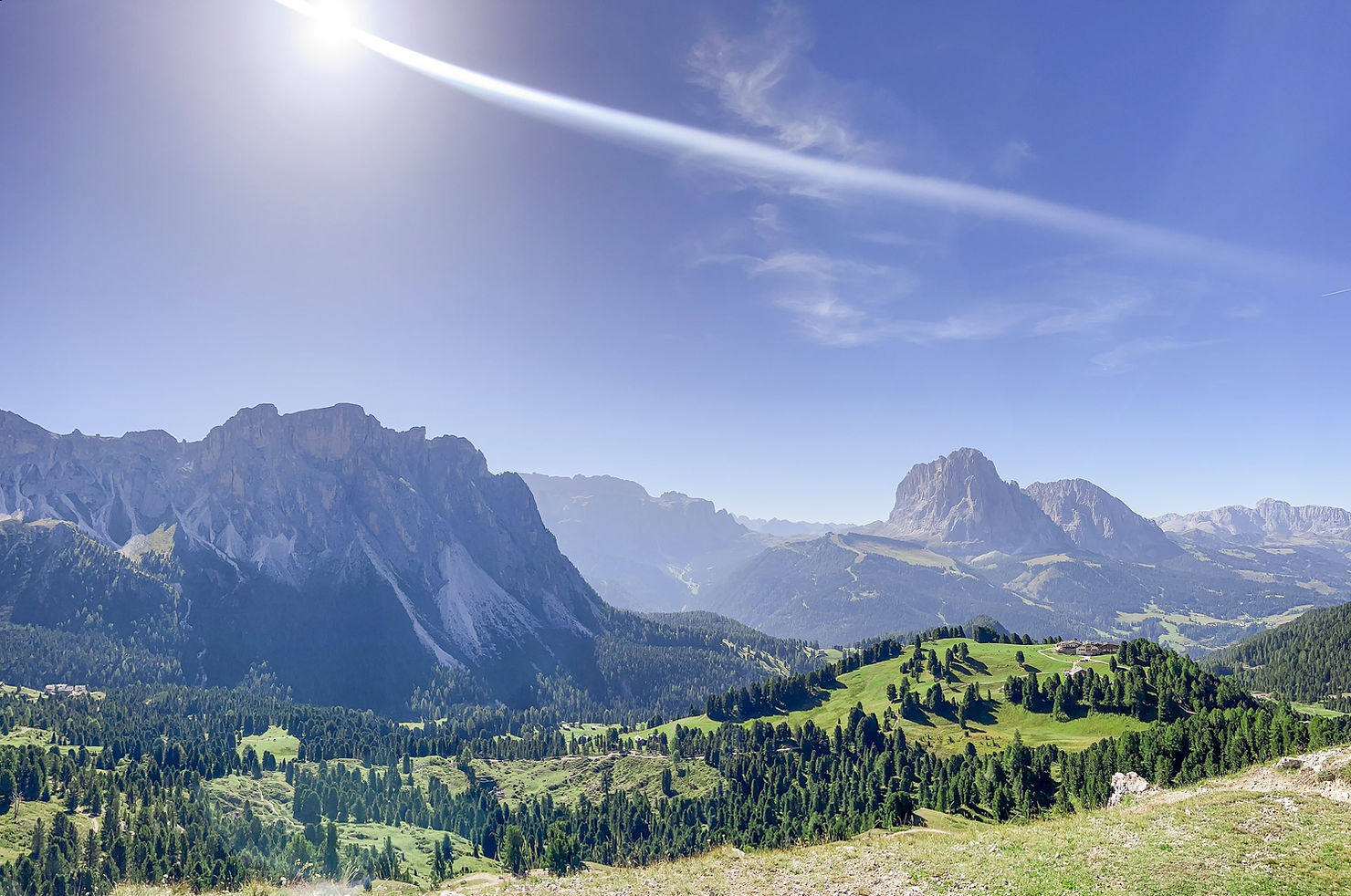
6. Gran Cir
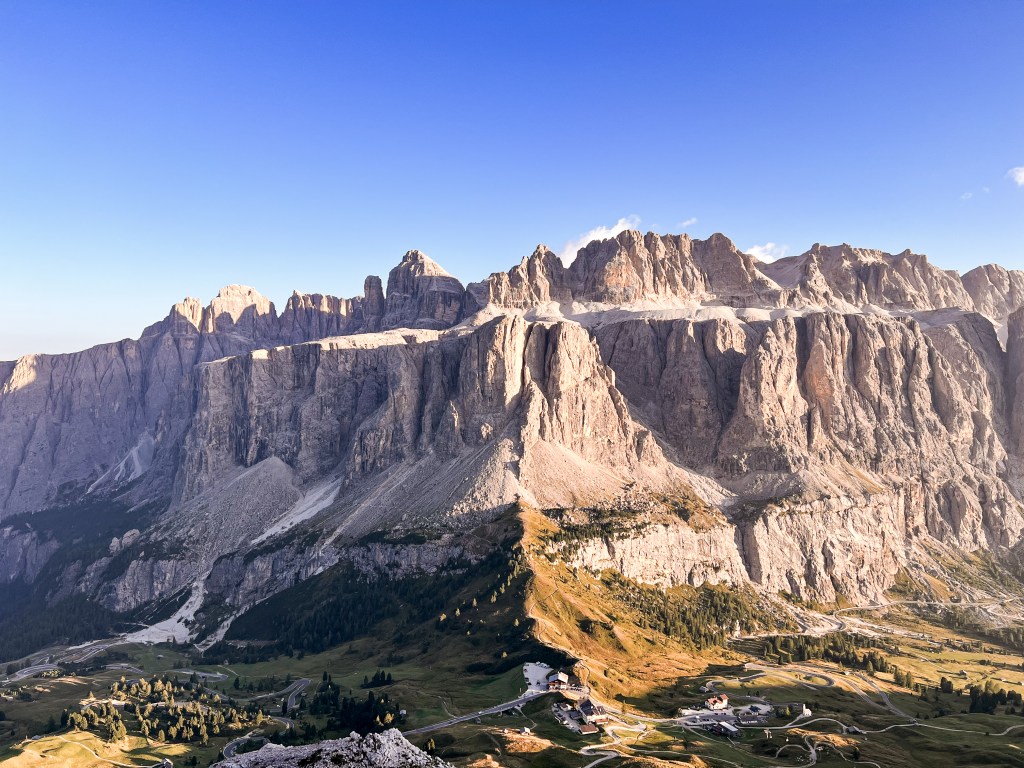
Gran Cir (Pizes de Cir) is a popular hiking destination, which can be easily accessed from Passo Gardena, the pass connecting Val Gardena and Val Badia. Gran Cir is famous for being a top spot for experiencing breathtaking sunrise and sunset views, showcasing the stunning Sella Group, Langkofel Group, and Val de Chedul.
Following a relaxing day in Corvara in Badia, we decided to take the bus instead of the car up to Passo Gardena, with the plan of enjoying the sunset from the summit of Gran Cir. The bus journey was a bit of an adventure with the winding turns. While the hike covered a modest distance of about 4.5 kilometers, the elevation can be considered quite challenging. Scaling rocky terrain with secured passages, the panoramic view from the summit made every effort worthwhile. This is a place etched in my memory – a surreal, out of this world view.
On our way back, we illuminated our flashlights (prepared in advance, as we had planned to wait for the sunset) and descended to the campsite. It was a bit spooky, but what an unforgettable experience.
Gran Cir is classified as a “sentiero attrezzato”, which translates to an easy via ferrata, but the actual via ferrata part is very short. We would characterize it as a challenging hike, with two secure passages where fixed cables ensure a safe ascent and descent. What makes it difficult is the terrain and the elevation gain during the hike, so the most important thing for this hike is to wear proper hiking boots, not sneakers. Also, if you’re afraid of heights, this might not be the place for you.
Gran Cir trail:
- Distance: 4.5 km
- Difficulty: moderate/difficult
- Elevation: ~450m
- Starting point: Passo Gardena
7. Seceda
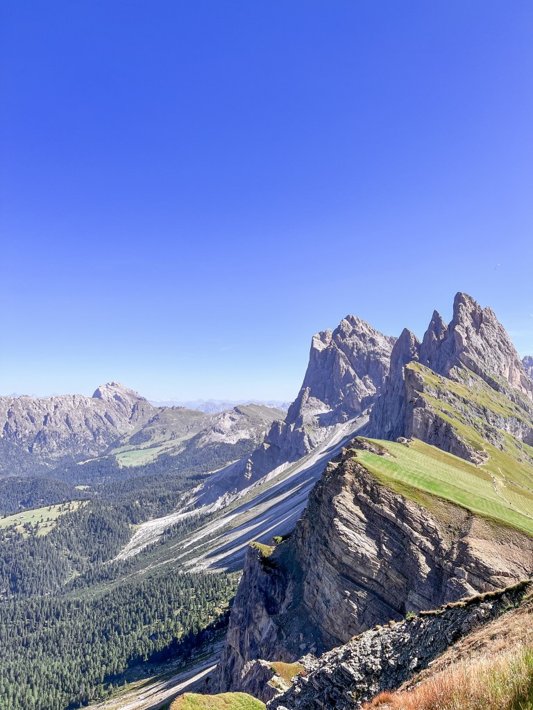
The summit of Seceda (2519 meters) is another popular destination is the Dolomites, because of its incredible view of the Odle/Geisler Peaks.
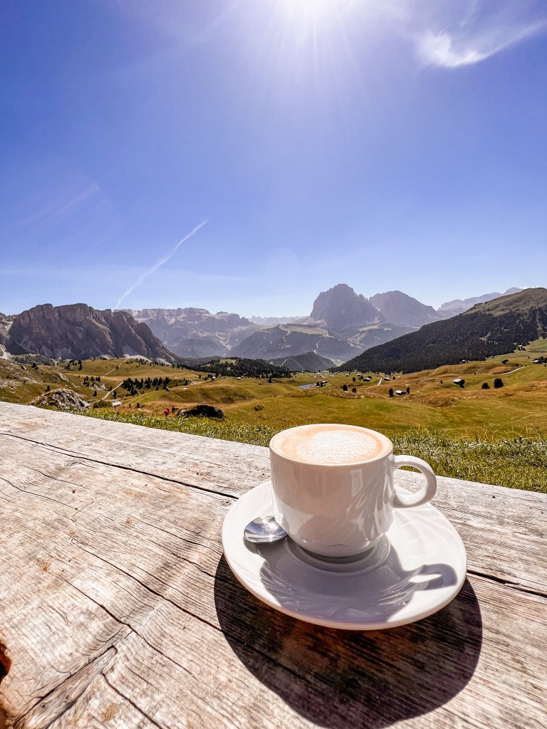
The Seceda area is accessible by cable car (39.50€ for adults) from the villages of Ortisei and Santa Cristina, but there are various hiking trails around Seceda, serving different hiking skill levels. The trails offer opportunities to explore alpine meadows, unique rock formations, and enjoy amazing views of the surrounding Dolomite peaks. We decided to hike the trail with number 3 from the village Daunei, a challenging ~20 kilometer hike with more than 1000 meters of elevation. At the top, a panoramic terrace provides a 360-degree view of the surrounding mountains and peaks. You can also find a circular diorama with the list of all the peaks that can be seen from the Seceda summit. It’s also an excellent spot to relax and take in the scenery.
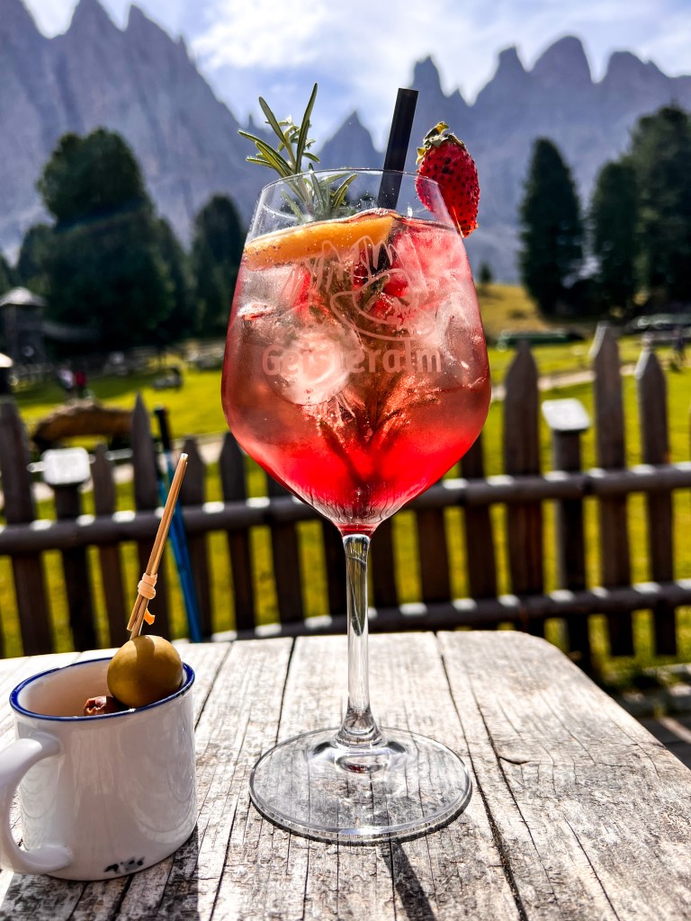
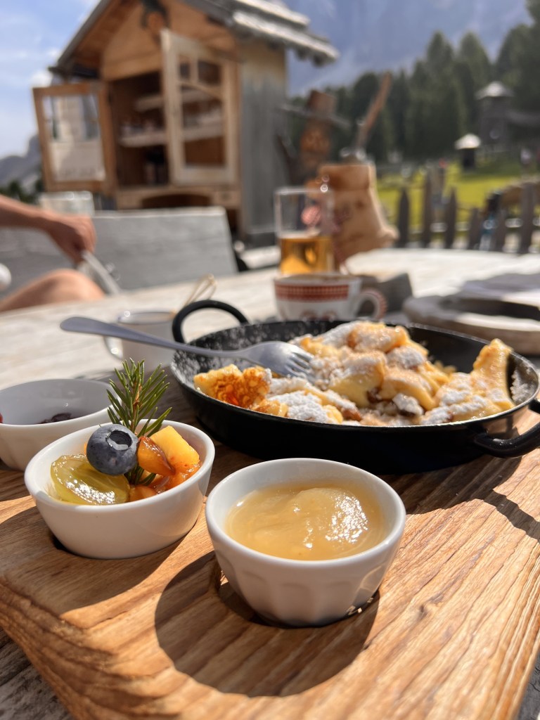
Along some of the trails, you’ll find mountain huts where you can savor local cuisine and refreshments. These huts offer a welcoming break during your exploration. We also stopped at one of the huts for a well deserved Kaiserschmarrn (traditional Austrian desert) with a nice cup of coffee. This is what I call coffee with a view.
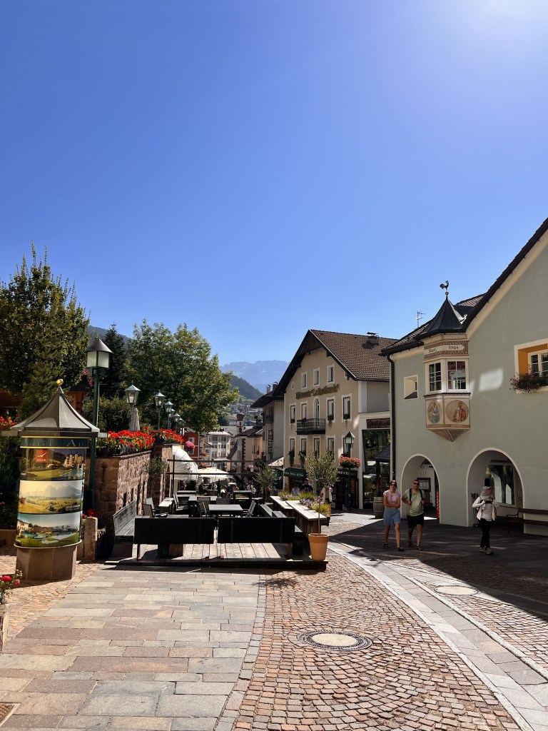
8. Ortisei and Klausen
After the challenging hike in Seceda, we decided to take a day off, wander around in Val Gardena, and visit the charming town Ortisei. Ortisei is easily accessible by road and public transportation, making it a convenient base for exploring the Val Gardena region. It is well-connected to neighboring towns and attractions. Strolling through the center and shopping for Limoncello and other goods, we found a short hike (rather a walk) to St.-Jakobs-Kirche, the oldest church in Val Gardena. First written documents date back to August 18, 1283.
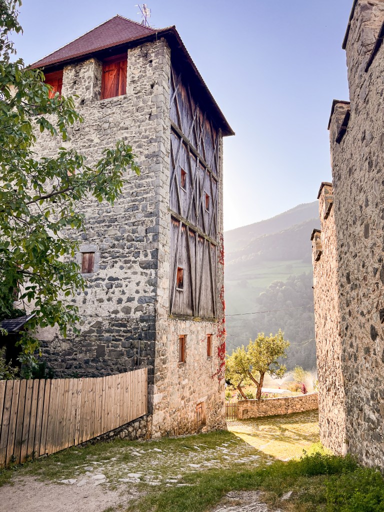
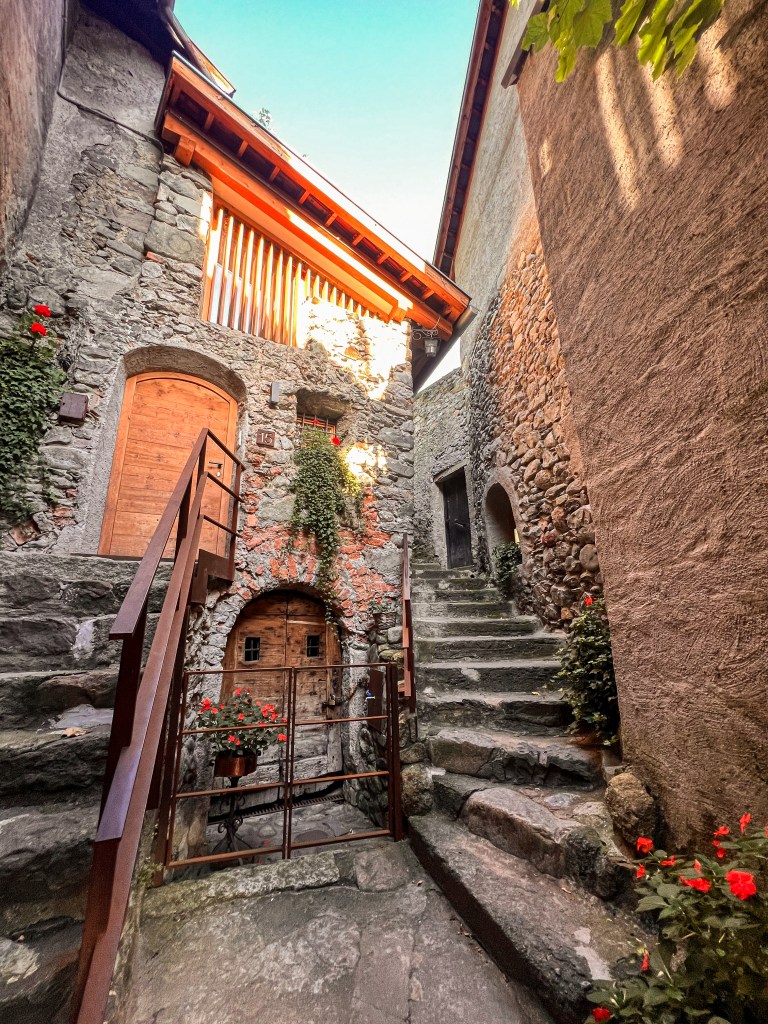

Without prior reservations for the night, we searched for a camping spot and stumbled upon the charming town of Klausen. This hidden gem took us by surprise — it lacked the touristy hustle yet captivated us with its architecture. On top of a hill, a small castle graced the town, and its garden is open for free visits at any time of the day. Klausen turned out to be a delightful surprise, a town with a pleasant vibe and calmness.
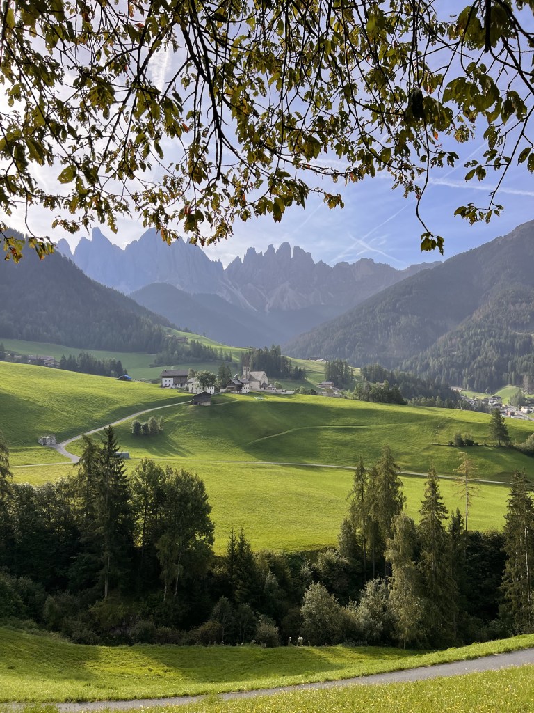
9. Val di Funes and Santa Maddalena
Val di Funes is a picturesque valley that enchants visitors with its alpine beauty and charming villages. The valley is rich in cultural heritage, with historic churches, chapels, and traditional alpine architecture. One such village, Santa Maddalena, the most popular in the valley, is known for its charming church, Chiesa di Santa Maddalena. From the Santa Maddalena viewpoint you can see the beauty of Val di Funes, its stunning landscapes, lush green meadows, rolling hills, and the iconic backdrop of the Geisler/Odle Group.
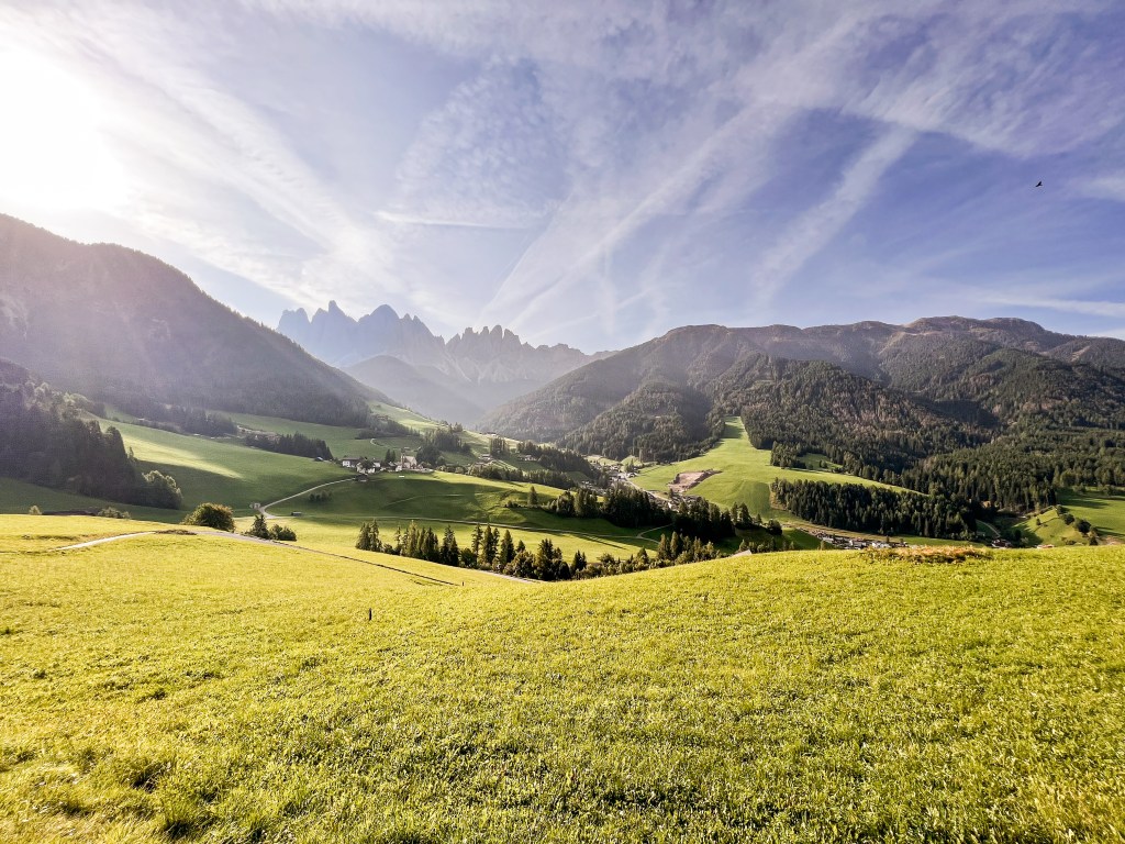
Not so far you can find another iconic church, Church of St. John. The iconic set against the Geisler/Odle peaks is another famous destination in the valley
10. Adolf Munkel Weg
After visiting Val di Funes in the morning, we headed to our last hike in the Dolomites, named the Adolf Munkel Weg, or Sentiero Adolf Munkel (in Italian). The path that runs along the northern foot of the Geisler/Odle Group
To reach the trail head, continue driving to the head of Val di Funes valley until you arrive at Zannes/Zans. There is a big parking lot, pay the parking fee at the toll (8€ for cars) and park wherever you find a free spot.
Following the trail number 6, we started our 9.5 kilometer hike. The Adolf Munkel Trail is an easy and diverse route that passes through forests and alpine meadows, reaching its highest points at Gschnagenhardt Alm and Geisler Alm.
Reaching Geisler Alm, we stopped for a last lunch in the Dolomites. The Geisler Alm is one of the most popular huts in the area. From the terrace, the Geisler/Odle Group serves magnificent view. My choice was Keiserschmarrn of course, with coffee and a cocktail. The perfect ending for the perfect vacation.
Adolf Munkel Weg
- Distance: 9.5 km
- Difficulty: easy/moderate
- Elevation: 380m
- Starting point: Zannes car park
- Trail numbers: 6, 36, 35
There we go! Ten incredibly beautiful places to explore in the Italian Dolomites. My 10 days here were truly magical and absolutely worth every effort. I highly recommend this stunning part of the world. This road trip is the one I would do over and over again, I’ll definitely come back one day, and explore other parts of the Dolomites, the area of Trento, Madonna di Campiglio, Lago di Carezza.

Leave a comment